
Route Mapping Websites
You will find a number of very good tools to help you generate a route or follow a trail that someone else has ridden and published.
Some suggested sites include:
Starva, Bike hub, Endomondo, View Ranger, Runtastic and UBYK
I suggest you have a look at these and try the different features, we are all different in our needs and pick and choose the one that work for you.
Apps for your Phone
Most websites come with complementary Apps designed to help you get around the trails.
Maps
Always carry a Map if you are on unfamiliar territory or out on the open moors and fells. Its all too easy to become disorientated when the weather deteriorates. A good OS map is again my recommendation and one with a decent scale so you can see the features. Small things that are visible can be a big help when checking position on a map.
Cycle Computers
Cycle computers can also be very useful for you as a trail rider. There is a wide range of options when it comes down to functionality. So you can pay a few pounds to around a thousand for some of the higher specification models.
Makers include, Garmin and Mio,
Where can you ride?
There is loads of roads, but if you are like me you will want to know where else we can ride.
Cycle paths are common around many parts of the country but in some places (like my local area) there we dont have one within 15 miles.
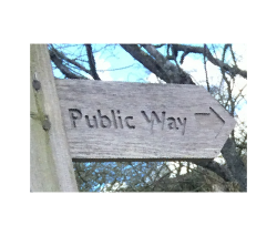
Bridleway , Public Way , BOATs , Green Lanes & White Roads
But what are these and what do the look like on maps?
|
_ _ _ _ _ _ _ _
|
Footpath
|
|
__ __ __ __ __ __
|
Bridleway
|
|
|
|
|
|
|
|
|
|
Copyright Selca.co.uk 2016
